User:Iketsi
Jump to navigation
Jump to search
|
Helpful
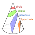
[edit]- SVG (File:Conic Sections.svg)
{{Inform|desc=|date=2024-06-06/{{other date|?}}|sour={{Own based|Secciones cónicas.svg|b1=Magister Mathematicae}}|auth=//Formats nicely in Media Viewer{{Author|original|{{U|Magister Mathematicae}}}}{{Clear}}{{Author|derivative|{{Uc|Phancy Physicist}}}}{{Clear}}{{Author|i18n|{{U|Glrx}}}}{{Clear}}{{Author-translation header}}{{Columns|width=20em|text={{ulist|{{Author-translation|af|Iketsi}}|{{Author-translation|io|Joao Xavier|Iketsi}}|{{Author-translation|sr-cyrl|Kizule|Magog the Ogre}}*|{{Author-translation|qsc|Iketsi}}
|perm=-|vers={{Other versions/Example}}|fiel={{Igen|Ih|+|%s%|w=t|s1=2023-09-23|c1=SOURCECODE}}}}
Howto
[edit]Maps:
- Change
{{Information}}to{{Map}} - Add
|warp_status=warped - Click on the View the georeferenced map in the Wikimaps Warper button
- In Wikimaps Warper, click on Add this map
Mapoj: -
Cartes : -
Mapy: -
OSM Zoom levels
[edit]Source: https://wiki.openstreetmap.org/wiki/Zoom_levels
Useful
[edit]- Magic word for fetching Mediawiki UI elements: {{int|vector-view-history|lang=de}}
- SVG knowledge: User:Glrx, User:Cmglee, User:Alhadis
- SUL stats
{{Location estimated}}
The geographical information in this file was retrospectively estimated.
The location may therefore be somewhat imprecise. Verifying and refining these coordinates is strongly encouraged. |
{{On OSM|type=node|OSM_ID=8497176072}}
|
Iketsi has an entry on OpenStreetMap (show). |
- Geolocator: look for the coordinates in the map.
- If the coordinates refer to the camera's location, copy the resulting {{location}} or {{location dec}} markup to the appropriate Commons page, and that's all; if the coordinates refer to the object's location, use the {{Object location}} or {{Object location dec}} template instead.
Todo
[edit]- Subcategorize Category:Other versions templates
- Expand and improve Commons:Multilingual tags
- Add switch translations to File:Peryhelium-aphelium.svg
- Translate Template:Occupation/list subpages
- Fix Template:Fictitious flag for Category:Fictional flags of Arkansas
- Template:Cat multilingual object/testcases
- Merge cats Category:Works-by-year_templates_for_art
- Create template for Arrays by number of cells
- Generalize {{VehicleColors}}
- File:Chongqing1.svg
Flags
[edit]Bilingual categories by country
[edit]Pending
[edit]- 2024-02-19 User_talk:Verdy_p#Modification_du_modèle_Lang_gallery
- 2024-02-19 User_talk:Fæ/Userlist#Down?_3
- 2024-02-03 User_talk:Pfctdayelise#Source_for_Commons:Registered_users_by_language_preference?
- 2024-01-28 Template talk:Superseded/layout
- 2024-01-08 User_talk:JamesLucas#File:Троянда-компаса-32-pt.svg and en:User_talk:JamesLucas#File:Троянда-компаса-32-pt.svg
- 2023-09-24 en:Wikipedia:Templates_for_discussion/Log/2023_September_19#Template:Comparison_Arabic_alphabet
 Done 2023-08-26 File talk:Portugués europeo.png
- 2023-08-26 File talk:Pop Goes the Weasel melody.PNG
- 2021-04-05 Category talk:Prohibition signs
- 2021-04-02 File talk:İstanbul - Soğukçeşme Sokağı r1 - Mart 2013.JPG
- 2021-03-29 File talk:2015 Statue von Halide Edib Adıvar (117LIEBE 1398).jpg
- Done 2020-03-08 File talk:Pořadí vlajek při vyvěšování.svg
 On hold 2020-02-03 Template_talk:Multilingual_description#Adding_a_tooltip_to_display_the_name_of_particular_languages_in_the_user's_local_language
~
[edit]Templates
[edit]for files
[edit]- {{F}}
- {{unknown|author}}
- {{Categorize}}
- {{Watermark}}
- {{Watermark|timestamp}}
- {{Image extracted|Example.jpg}}
- {{RAW}}
- {{Superseded|Example.svg}}
- {{Easy-border}}
- {{Set}}
- {{PermissionTicket}}: Verónica Bonilla
- {{Language}} – for annotations
for categories
[edit]- {{Geogroup}}
{{MetaCat|country}}{{SD|C1|Misspeld}}{{Diffusion by condition|count=50|category=Categories in Ukraine requiring diffusion}}- {{Category tree all|Diagrams in Low German|mode=parents|alignright=yes}}
for discussions
[edit]{{Outdent}}
for templates
[edit]{{int:lang}}to get uselang code:en
Licenses
[edit]{{PD-ineligible}}{{PD-old}}{{PD-USGov-Military-Army-USACE}}
Scripts
[edit]Links
[edit]- Sbx (potd; stats; flags; people; flags-cat; countries; housenums; maps; symbols; cat/academics)
- Gov images
- Sbx2
- Sbx3 – logical and consistent template set of templates for "By year" categories
- WikiProject Signage (Stats; todo; WikiProject Signage Sandbox)
- User:OgreBot/Uploads by new users
- Category:Images with borders
Tools
[edit]Contributions to files — nuts and bolts
[edit]SVG files translated
[edit]-

-
 zxx af ast az be be-tarask bs cs eo eu gl hr hsb (partial) io is la lv nb nn pms smn sr sr-latn (qsl) sr-cyrl (qsc) sh sh-latn (qhl) sh-cyrl (qhc)
 -
 fr pl
fr pl -

-


SVG files created — original works
[edit]- SVG: Hand-coded in a text editor
-

-

-

-

-

-

-

-

-

-


_mul.svg)


SVG files created — derivative works
[edit]


3085
SVG files created — vectorizations
[edit]-
 35,055 → 4,290 bytes (-88%)
 -
 Rewritten from scratch 6,388 → 115 bytes (-98%)
 -

 Redrawn from scratch 3,085 → 1,252 bytes (-59%).
 -
 Rewritten from scratch 556 → 211 bytes (-62%)
 -
 Rewritten from scratch 390 → 200 bytes (-49%)
 -
 Based on an English Wikipedia template, which itself is probably based on an image from 2003.
 -

-

-


SVG files improved – optimizations
[edit]Quality images - invalid vector
-
 281 → 139 bytes (-51%)
 -
 2,287 → 172 bytes (-92%)
 -
 27,431 → 178 bytes (-99.4%)
 -
 3,794 → 1,512 bytes (-60%) (1140 without comments)
 -
 6,738 → 773 bytes (-89%)
 -
 1,891 → 170 bytes (-91%)
 -
 190 → 99 bytes (-48%)
 -

 Optimized carefully using SVGO (more work left) 188,825 → 67,099 bytes (-64%)
 -
 Optimized carefully using SVGO (more work left) 166,585 → 47,414 bytes (-72%)
 -

-
 Rewritten from scratch 1,640 → 189 bytes (-88%)
 -
 Rewritten from scratch 265 → 175 bytes (-34%)
 -
 Rewritten from scratch 815 → 553 bytes (-32%)


.svg)

.svg)


PNG files created — original screenshots
[edit]- PNG: Multilingual series of screenshots
-
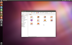 Ubuntu 11.04—5 locales (csb/eo/is/fi/pl); 1680×1050 px (16:10)
 -
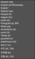
 Brave 1.57.57 macOS—55 locales; 1024×768 px (4:3)
 -
 Gifski 2.21.2—4 images, 2 color schemes
 -
 VirtualBox 7.0—31 locales; 640×480 px (4:3)
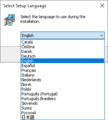
 -
 ImageOptim 1.8.8 macOS—27 locales; variable width (fixed height)
.png)


- PNG: Screenshots of software
-
 Newsbeuter.png
 -
 CinePaint 800×600 px (4:3)
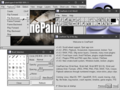
 -
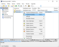
 DeepL annotated; 800×600 px (4:3)
 -

-
-

-
-
-

-
-

-

-

-
-

-
-
-
-


.png)


.png)

.png)
.png)
_rendered_as_6C49_8BED.png)


GIF files created — animations
[edit]-
 animated GIF; 800×600 (4:3)

Files I tagged
[edit]English: This list is incomplete.
Files I nominated for deletion
[edit]Copyright violation ("copyvio")
[edit]- File:Conqueror Home.png
- File:Abiword2.PNG
- File:Abiword2.JPG
- File:3c71d3 e60c6fc2bf014f83be6675307c4bebcc~mv2.png
- File:3c71d3 ab421b3ee18e4e37b4ef0eb16cef47d1~mv2.png
- File:Weiblicher Turmfalke 3543.467.jpg
- File:Vaca abducida.png
- File:אוסף התצלומים הלאומי שפרירה זכאי במחזה ״די כתובה״..jpeg
- File:The sopranos logo.png
Supersessions ("superseded")
[edit]- Supersession — GIF/JPG→PNG
- Supersession — Raster→SVG
- File:Flag of Ido.jpg
- File:Kuressaare flag.png
- File:Flag of Kohtla-Jarve.gif
- File:Keila flag.png
- File:Maardu flag.png
- File:Kadrina vald flag.png
- File:Kadrina vald flag.png
- File:Kiili vald flag.png
- File:Otepaa vald flag.png
- File:Torva flag.png
- File:Jogeva flag.png
- File:Vorumaa flag.png
- File:Flag of Vihula Parish.gif
- File:EST Vihula vald flag.png
- File:Loksa suurlipp.gif
- File:Loksa suurlipp.gif
- File:Saaremaa flag.png
- File:Tartumaa flag.png
- File:Abja valla lipp.gif
- File:Haapsalu flag.png
- File:Viljandimaa flag.png
- File:Imavere valla lipp.gif
- File:Valgamaa flag.png
- File:Patriotes.gif
File:Slovake.eu emblemo.jpg- File:Bild-Leser nach Schulabschluss.jpg
- File:Bild-Leser nach Geschlecht.jpg
- Supersession — Superior alt. with same ext. exist
File:MiTeTaiPoutini.png- File:Darktable 1.0 default swedish.jpg
- File:Jogeva coatofarms.png
- File:Bandera del Poble Livoni.svg
- File:HUN Szágy COA.jpg
File:Vükiped Cifapad 2012-11-15.png- File:Blank-world-range-map.png
- Supersession — Corrected version uploaded
Unencyclopedic/Nonsense
[edit]- File:GUI in da place.jpg
- File:Ass niki.jpg
- File:Adjkfkaaaa.png
- File:2006 GOLDSENATE.png
- File:2004GOLDSENATE.png
- File:2004GOLDSENATE Fixed.png
- File:صورمشبات,ديكورات مشبات.jpg
File:Kit body bodo2021h.png- File:شو.png
- File:Es1223ds.png
- File:ՀՀ դրոշ.jpg
- File:O Dentadura.jpg
- File:TheThing.jpg
Duplicate (merging/redirection requested)
[edit]Screenshot of existing file
[edit]Just bad in many ways
[edit]Misclick
[edit]Contributions to files — bells and whistles
[edit]Files annotated (ImageNote)
[edit]to enhance maps
[edit]- File:CornwallKernowMappa.png
- File:Asia (orthographic projection).svg
- File:Urartu 820 785-fr.svg
- File:Kantone der Schweiz.svg
to explain/clarify — errors in photographs
[edit]to explain/clarify — errors in screenshots
[edit]- File:I18n list darktable 4.0.0 eo (18).png
- File:I18n list darktable 4.0.0 Windows 10 mojibake 汉语 (U+6C49 U+8BED) rendered as 6C49 8BED.png
- File:Screenshot of DVD Flick 1.3.0.7 build 738.png—Thanks to User:FleetCommand for documenting it on rev. en.wp:#474846390
- File:X4view hello world.png
to identify — languages/scripts
[edit]- File:Wikimedia Finland's Helsinki Then and Now exhibition in Brygga DEC2019 11.jpg
- File:Wikimedia Finland's Helsinki Then and Now exhibition in Brygga DEC2019 09.jpg
- File:Wikimedia Finland's Helsinki Then and Now exhibition in Brygga DEC2019 13.jpg
- File:Cisneros' original complutensian polyglot Bible -2.jpg
- File:I18n list KeePass 2.54 Select Setup Language drop-down list during installation on Windows 10.png
- File:Unifont Sample, v10.0.06.png
- File:2007 07 Willkommen in Wilhelmshaven.JPG
- File:Interwiki Languages Ænglisc.png
to identify — people
[edit]- File:No. 302 (Polish) Squadron RAF (Sep 1944).jpg
- File:Euskal wikilariak Baionan 5.jpg
- File:Bundesarchiv Bild 183-M1114-0041, Berlin, VII. Schriftstellerkongress, Eröffnung.jpg
- File:Myga, Nowicka, 2010.10.28, fot Maria Nowicka.jpg
to identify — elements
[edit]to identify — works
[edit]to improve text legibility
[edit]- File:A view of the wall (4316396373).jpg
- File:Topinard nasal index.png
- File:Hole 7 at Golden Gate Disc Golf Course - San Francisco Recreation & Parks.jpg
- File:King George Island Base Presidente Eduardo Frei 2.jpg
- File:Sondrestrom Air Base, August 1974 01.jpg
- File:Sondrestrom Air Base, August 1974 02.jpg
to link to relevant Commons categories
[edit]- File:Bundesarchiv Bild 183-40000-0089, Horst Fritsche.jpg
- File:Roman Amphitheatre, Parc de l'amfiteatre, Tarragona, Catalonia, Spain - Flickr - Stuart Smith.jpg
- File:Elevated Teepad in Wine Country (14212823404).jpg
- File:5th Annual Young at Heart Parent-Child Doubles Tournament at Flying Armadillo Disc Golf Club - 23977642098 (cropped on sunken basket).jpg
- File:Just what the home office needed. -discgolf (14611090221).jpg
- File:Great Seal State Park (52923870631) (square crop).jpg
- File:Disc golf basket 3 and 10 in Yyteri (cropped to show number plate).jpg
- File:Dynamic Discs disc golf bag with discs and Discraft towel on grass.jpg
- File:Zapiekanka 3 (270°).jpg – rotated
- File:Chłopiec wcina zapiekankę Zapiekanki Tradycyjne Jadłospis Rokicie Nowe, Łódź 20150412 141417 (16511795553).jpg
- File:Zapiekanka 3.jpg
- File:Fotografix logo.png
- File:Menu (computing) example.PNG
- File:Dåp av FF Geologen (52759822434) (beskåret på Direktør May Britt Myhr).jpg
- File:Conqueror Browser Build 1.0 EN on Windows 7 - Google India Home Page.png
- File:Frisbee Dog, Ford Park 1-19-14 (12226983266).jpg
- File:Old Settlers Disc Golf Course - Kelly at hole 13.jpg
- File:Disc Golf Hole (885131964).jpg
- File:StylizedDiscGolfBasket.gif
- File:Disc Golf at Beacon Hill Park - U.S. Army Garrison Humphreys, South Korea - 19 Oct 2013 (10392770103).jpg
- File:010511-a-NY741 (cropped on Next Tee sign).jpg
- File:16 frisbee (cropped to NEXT TEE sign).jpg
- File:Old sign next to ten green at spook.jpg
- File:Next Tee.jpg
- File:Saving Wild Ohio Disc Golf Fundraiser 2021 (51284807985).jpg
- File:Disc Golf "Hole" In Ithaca's "Strawberry Fields".jpg
- File:Disc golf at Brooks Memorial State Park (cropped on NEXT HOLE sign).jpg
- File:2009-01-04 Nate Dizo's disc in basket 12 (cropped on handwritten next tee 12 arrow).jpg
- File:2009-01-04 Nate Dizo's disc in basket 12.jpg
- File:Northern State Hospital - disc golf 04 (cropped on alternative basket on hole 12).jpg
- File:4th Annual Young At Heart Parent-Child Doubles at Flying Armadillo Disc Golf Club (27179100666) (cropped 4x3).jpg
- File:Saving Wild Ohio Disc Golf Fundraiser 2021 (51284808420) (cropped square).jpg
- File:Riverside Disc Golf sign (cropped square).jpeg
- File:5th to 6th pitch 6585 (cropped to next tee sign).jpg
- File:Disc golf hole -8 is 300 yards ahead (32801409572) (cropped).jpg
- File:Hall of Fame Classic - Steve Ganz - 5687975918 (cropped on next tee indicator on pin).jpg
- File:FEW Disc Golfing - 1865612947 (cropped on next tee sign hole 13).jpg
- File:Alireza Doulatszahi, Zofia Fornal, 2007, fot I Nowicka (cropped to Zofia Banet-Fornalowa).jpg
- File:Women playing disc golf at Lakes of Pelangi Indah Disc Golf Course (cropped).jpg
- File:Alireza Doulatszahi, Zofia Fornal, 2007, fot I Nowicka (cropped to Zofia Banet-Fornalowa).jpg
- File:JFornalZFornalowa (cropped to Zofia Banet-Fornalowa).jpg
- File:JFornalZFornalowa (cropped to Jerzy Fornal).jpg
- File:Masoud Sabbaghan.jpg
- File:Chen Mengjia and Zhao Luorui (cropped to 赵萝蕤).jpg
- File:Juri Durkot und Sabine Stöhr - Preis der Leipziger Buchmesse 2018 - Kategorie Übersetzung (cropped to Sabine Stöhr).jpg
- File:At the premiere of Ludo in the Nordic House in Torshavn (cropped to Hugin Eide).JPG
- File:The actors of the film Ludo by Kartin Ottarsdottir (cropped to Hildigunn Eyðfinnsdóttir).JPG
- File:European Voices A Reading and Conversation with Hubert Klimko-Dobrzaniecki and Julia Sherwood (26194812731) (cropped).jpg
- File:Uitreiking M Nijhoffprijs te Den Haag door Professor mr G J Wiarda (links), Bestanddeelnr 909-2784 (cropped to Dolf Verspoor).jpg
- File:Uitreiking M Nijhoffprijs te Den Haag door Professor mr G J Wiarda (links), Bestanddeelnr 909-2784 (cropped to Gerardus Johannes Wiarda).jpg
- File:Prabhakar mandaara.JPG
- File:Tom Drury and R. Jay Magill, Jr., 2017 (1) (cropped to R. Jay Magill, Jr.).jpg
- File:Myga, Nowicka, 2010.10.28, fot Maria Nowicka (cropped to Zbigniew Myga).jpg
- File:Myga, Nowicka, 2010.10.28, fot Maria Nowicka (cropped to Ivonna Nowicka).jpg
- File:Marica Bodrožić,.jpg
- File:Bundesarchiv Bild 183-M1116-0010, Berlin, Schriftstellerkongress, Kelm, Koprowski, Fühmann, Morgner (cropped to Kurt Kelm).jpg
- File:Bundesarchiv Bild 183-M1116-0010, Berlin, Schriftstellerkongress, Kelm, Koprowski, Fühmann, Morgner (cropped to Irmtraud Morgner).jpg
- File:Vaaskivi-Vaara (cropped to Elina Vaara).jpg
- File:Vaaskivi-Vaara (cropped to Tatu Vaaskivi).jpg
- File:Korjus+Želve.IMG 8270 (cropped to Kristīne Želve).JPG
- File:Korjus+Želve.IMG 8270 (cropped to Hannes Korjus).JPG
- File:Härm-Portsmuht-Ehala.IMG 5947 (cropped to Viiu Härm).JPG
- File:Szilágyi Domokos.jpg
- File:Peter Pan-priset på Seriescenen 2018 (pict2185) (cropped to Mats Wänblad).jpg
- File:Committee-discusses-for-the-new-elementary-girls-50-year-anniversary-391842697375 (cropped to Ingegerd Granlund).jpg
- File:Nino Raspudić and Iko Skoko in Mostar, 2014 (cropped on Nino Raspudić).jpg
- File:Deutsch-Israelische-Gesellschaft Hannover e.V. - Verleihung des Theodor-Lessing-Preises 2013 an Iris Berben 07 (cropped on Kay Schweigmann-Greve).jpg
- File:Hemeroteka Karlos del Olmo2001 (cropped to Aitor Arana).jpg
- File:SixFlagsOfTexas.jpg
- File:Richter; Miss Lagler, German Avt. LCCN2014693786 (cropped to Hans Richter).jpg
- File:Sebastian Kawa and Maximilian Seis (cropped to Maximilian Seis).JPG
- File:Mlle Louise CORNAZ (Joseph Autier), écrivain, Montet-Cudrefin (Vaud) 1839-1914 Photo Nitsche, Lausanne (cropped).jpg
- File:Large lizard with two tails bw 1977 Karelia.jpg
- File:Formosa, Carmel.jpg
- File:Alfred Sant.jpg
- File:Keith Azzopardi 2013-10-24 CTBTO.jpg
- File:P6077457 (3608921416).jpg
- File:Aegisida 1.jpg
- File:Rasjken Ozks 2007 100 0489.jpg
- File:Erzya Language Day 2008 04 16.jpg
- File:Shtatol OYME.jpg
- File:Rasjken Ozks P7104140.jpg
- File:Harry und Sally bei Katz' Deli.JPG
- File:Alfred Jarry, Deux aspects de la marionnette originale d'Ubu Roi.jpg
- File:Most na Nové řece - panoramio.jpg
- File:ACCESUL INTERZIS 2004.jpg
- File:Sara Nazarbayeva.jpeg
- File:Southern entry into Braşov on DN1 (E60) (5948254805).jpg
- File:Adriana Kučerová - 2015.jpg
- File:Women's visually impaired skier number 1.JPG
- File:Natália Šubrtová -G- + Henrieta Farkašová.jpeg
- File:Юлія Алейчанка 10+10.jpg
- File:Plavební kanál Nová řeka - panoramio.jpg
- File:Vista desde monsaraz (Fr Antunes).jpg
- File:Danuta Straszynska.jpg
- File:Amanita muscaria - Flickr - pete. ^hwcp.jpg
- File:July Fourth Celebration (20290889005).jpg
- File:Larus michahellis (49995863692).jpg
- File:Riga 20170706 154736.jpg
- File:Hanging in art using matches.jpg
- File:Week z00.jpg
- File:Starr 070908-9445 Morella faya.jpg
Files geolocated (Tag: OAuth CID: 544 "Wikimedia Commons Project Wikimaps Warper [2.2]")
[edit]- File:Nova et Accuratior Bornholmiae Maris Baltici Insulae Non Ingloriae Delineatio - Autore Petr. de Kofod ; D.C. Fester delineavit - btv1b53041336v.jpg
- File:Pointe de Givet-19 mai 1940-VR.jpg
- File:Admiralty Chart No 5 Indian Ocean -- Sokotra Surveyed by Lieutenants S.B. Haines and I.R. Wellsted, I.N. , Published 1835, Corrections to 1907.jpg
- File:Cantino planisphere (1502).jpg
- File:Zemljovid Slovenske dezele in pokrajin (alt).jpg
- File:Oude-hollandse-waterlinie.png
- File:Magni Ducatus Lithuaniae, et Regionum Adiacentium exacta Descriptio.jpg
- File:Duchy of Oświęcim medieval settlements.png
- File:Vatican City map EN.png
- File:Plan de l'île d'Aix en 1693.jpg
- File:Parszowice (1) tablica plan wsi.jpg
- File:Walnut Ridge Disc Golf Course Map.jpg
- File:Lucky Peak Lake Recreation Areas.png
- File:Discgolf i Eslöv 18 hål 001.jpg
- File:Borkút Prešov 17 Slovakia8.jpg
Files imagemapped
[edit]Files improved (legend)
[edit]Files moved (renamed) (Tag: RenameLink)
[edit]Legend: move rejected; moved, but not as requested
Criterion #1 (original uploader's request)
[edit]- File:VIAF logo.svg
- File:I18n mojibake 汉语 (U+6C49 U+8BED) rendered as 6C49 8BED in Darktable 4.0.0 on Windows 10.png
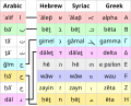
- File:Arabic vs Hebrew Syriac Greek.svg
- File:Restaurant menu at the Hotel Majestic in Ksamil, Albania, 2011.jpeg
Criterion #2 (meaningless/ambiguous name)
[edit]- File:Zrzut ekranu z 2015-11-29 12-52-19.png
- File:Zrzut ekranu3.png
- File:Graph(2).png
- File:DSC 7620 (14603092929).jpg
- File:20200701 200809 HDR.jpg
- File:FOTIADIS-1872-PNG.jpg
- File:Comparison of Fonts.png
- File:Spell check.PNG
- File:Map of the Philippines.png
- File:Percentage of Galician speakers (corrected).PNG
- File:Percentage of Galician speakers.PNG
- File:Bildschirmfoto1.png
- File:Capture d’écran de 2017-11-04 04-03-46.png
- File:Disc Golf (15207977759).jpg
- File:Mariehamn DGP.jpg
- File:Andrew launching from first holeAndrew launching from first hole (7685994078).jpg
- File:P1240333-4.jpg
- File:P081913PS-0659 (9551100090).jpg
- File:P00241006 092116801 2139BDFA-CD32-41C5-ACBD-3EF108F3FD97.jpg
- File:4f548cc532322-berg1 2012.jpg
- File:526a9d0a06140-gagocraneo1.jpg
- File:P1000971a.jpg
- File:P1000971.JPG
- File:IMAG1692.jpg
- File:Toilet Vomit Sign in.jpg
Criterion #3 (obvious errors)
[edit]- File:Myanmar3 Kayboard Layout.jpg
- File:Wikiproject locaator in hy.wiki.png
- File:Kirjamessut2017 .gif
- File:Le Toru Du MOnde.jpg
- File:Folf Musicians DSCF0397 (52618465465).jpg
- File:Folf tradition post wedding.jpg
- File:The to played all 11 courses at Åland (51110612750).jpg
- File:Disc golf target 12.jpg
- File:Dialects of Belarusian language be-tarask DE.png
- File:Darwin ,Australie.png
File:WInd Rose Aguiar.pngFile:WInd Rose Aguiar.svg- File:Recul géographique de l'aire traditionnelle du breton-en.svg
- File:Stanisław Ratusiński, Diplome Recorde 1962.jpg
- File:Piastowskie 21 Poznan.JPG
- File:Dobřany - náměstí, 16.jpg
- File:08 Plaque au Parc des Ancetre.png
- File:Contrada Del Pianello, 42, 47890 San Marino di Urbino SM, Italy - panoramio.jpg
- File:Monreal (6484156447).jpg
- File:Bilingual sign Ulqin, Montenegro.JPG
- File:Canada Panneau Aucune de Bicyclettes Sur le Trottoir.svg
Criterion #4 (harmony in a set of images)
[edit]File:Simple photosynthesis overview - Ar.png- File:Amarok 1.4.9 en.png
- File:109 0986 Disc golf basket viewed from the top.jpg
- File:Unifont-sample-v10.0.06.png
- File:Yandex ua.svg
- File:No drink sign.svg
- File:Meander ml.svg
- File:Meander as.svg
- File:Meander ro.svg
- File:Meander cs.svg
- File:Antarctic expedition map Amundsen - Scott-ca.svg
Criterion #6 (non-controversial maintenance and bug fixes)
[edit]- File:Roman Amphitheatre, Parc de l'amfiteatre, Tarragona, Catalonia, Spain - Flickr - Stuart Smith..jpg
- File:Response to Quality of Space sessions,.svg
- File:Book Rider .jpg
- File:Zapiekanka 3..jpg
- File:Zapiekanka 2..jpg
- File:Eika Vio . png.jpg
- File:Valanjanganam_Falls .jpg
- File:Maryšin rodný dům .jpg
- File:Cultural center jpg.jpg
Files transferred to Commons (Tag: fileimporter "Modified by FileImporter")
[edit]en.wpFile:Kofax logo.svgru.wpFile:Программа Rocket Dock.jpglt.wpFile:Opendict.jpgen.wpFile:Fuse surfaces.pngen.wpFile:Smls 090411.pnglt.wpFile:Xwd.jpgit.wpFile:Wikipedia 80x15 lb.pngru.wpFile:RussianLanguageMap Rus.pngen.wpFile:Ultimate Packer for eXecutebles.pngru.wpFile:FreeArc Windows.pngru.wpFile:FreeArc Linux.pngru.wpFile:FreeArc Icon.pngru.wpFile:FreeArc.pngru.wpFile:Foobar2000 v1.1 default ui.pngen.wpFile:Croquet Screenshot.jpegen.wpFile:Edit Source Code.jpegen.wpFile:Interactive 3D map of same world.jpgen.wpFile:Croquet Spreadsheet.jpegen.wpFile:StylizedDiscGolfBasket.gifen.wpFile:Tom monroe putt02.jpgen.wpFile:Tom monroe pose01.jpgen.wpFile:Tom monroe worlds 2002 houston winning putt.jpgen.wpFile:World Flying Disc Federation logo.svgeo.wpFile:JFornalEinstein.jpgeo.wpFile:JFornalZFornalowa.jpgen.wpFile:Kaifi Azmi in Annual Mushaira.JPGhe.wpFile:שפרירה-זכאי-דמעת-הנחמה-הגדולה.pnghe.wpFile:שפרירה זכאי תמונה מראיון אישי.jpeghe.wpFile:שפרירה זכאי הכתובה.jpeghe.wpFile:שפרירה-זכאי-1960.pngen.wpFile:Valdimar Briem.jpgbs.wpFile:Nikola Kovač.jpgru.wpFile:Félicien Chapuis (1824–1879).jpgen.wpFile:MuscatAzzopardi.jpgen.wpFile:Borġ in Nadur 2010 June 2010.jpgen.wpFile:Silveracademic.jpgen.wpFile:KaszebeGrifon.jpgen.wpFile:LasVegasSki&SnowboardResortsign.JPGen.wpFile:DelaPutt.jpg
lt.wpFile:Historical national (armorial) flag of Lithuania.svglt.wpFile:Diskgolfo diskai.jpglt.wpFile:Nesiojamas diskgolfo krepsys.jpglt.wpFile:Diskgolfas Lietuvoje.jpglt.wpFile:Elektrėnų diskgolfas.jpgeo.wpFile:EDE1.jpgeo.wpFile:EDE2.jpgeo.wpFile:EDE3.jpgeo.wpFile:1995 Komputika Leksikono.jpgeo.wpFile:1962 Lingvaj Respondoj.jpgen.wpFile:Brooks leather saddle.JPGlv.wpFile:Vikialus 2013 01.jpg
Contributions to categories
[edit]- Objects Rusty objects
- Fingerposts // categorize Fingerposts by Fingerposts to a country
- Flags Flags of ethnic groups
- Photographs Sepia photographsBlack and white photographs of sport // add {{Cat see also|Sepia photographs of XXXXXX}} to all sport subcategories
- Sports Disc golfCycling
- Stamps People of Armenia on stamps // continue adding templates to other countries
- Sundials Sundials
--
Categories — general
[edit]created
[edit]- Objects by inscription
- Coordinates on objects
- Collective pseudonyms
- 21???? Created subcategories for Sahitya Akademi Award
- 210403 Created Prohibition signs by prohibited action and Prohibition signs by prohibited object
- 211020 Created Association football clubs established in 2005
- 211025 Created Physical instances of digital objects
- 211115 Created Maps of countries visited
- 211120 Created Signatories of manifestos and added files and categories to Signatories of the Declaration on the Common Language
- Murdered journalists
- 220107 Created Lullabies by language
- International Dark-Sky Association
- Hover hands
- Telephone numbers on objects
- Telephone numbers on vehicles
- Handwriting on napkins
- Unlocalized software
- Autoglossonyms
- Time on screenshots
- Flags on screenshots
- Language lists
- Please touch
- Airplane mode
- Tip of the day
- 1% rule
- Dark-on-light logos and Light-on-dark logos
- Check for updates
- Comparison screenshots
- Partial translations
- Wikipedia in art
- Standard Unix programs and its subcategories
- Screenshots of Wikipedia's Top Ten page
- Barranquenho
- Mixed languages
- Aliased maps
- Esperanto spelling, X-sistemo, and Esperanto letter Ŭ as UX
- Bilingual belt and Belt regions
- Software by language and its subcategories (Asturian-language software, Basque-language software, Catalan-language software, etc.)
- Antipixels, Userbars, and 88 × 31 buttons
- Rendered currency signs and ₿ (text)
- Font rendering errors
- I heart
- Silkscreen (typeface)
- In case of fire signs
- Command-line software
- Pixel aspect ratio
- Screenshots of software with custom fonts
- Est. (text)
- Notification dots
- Photo shots
- Raster vs vector comparison diagrams
- On the Internet, nobody knows you're a dog
General
[edit]- Distinguished/Untangled:
- 210307 Separated Foundations in Hungary (construction) from Foundations of Hungary (organizations) for every country
- 21???? Distinguished Category:People on stamps of Belarus from Category:People of Belarus on stamps (all countries)
- 211010 Continue creating categories distinguishing Members of learned societies of the United Kingdom from Members of learned societies from the United Kingdom for proper interwikis between wikis where such a distinction exists.
- 211011 Created Academicians and untangled Academician vs Academic categories across languages: eo, ru, be, be-tarask
- 211031 Untangled Norwegian Wikipedias (Q191769), Norwegian (Bokmål) Wikipedia (Q109333352), Norwegian (Nynorsk) Wikipedia (Q2349453), and Norwegian Wikipedias (disambiguation) (Q12905544) on Wikidata and Commons.
- 211113 Cleaned up Signatories by redirecting it to Signatories by type of document, systematizing its subcategories, adding {{Wikidata Infobox}}, and linking them to Wikidata and Wikipedia articles.
- 230819 Created Enlightenment disambiguation page to distinguish Enlightenment (spiritual) from Enlightenment (software).
- 230822 Created Conqueror Browser and distinguished it from Konqueror and Conkeror, since some files were incorrectly categorized under Category:Konqueror.
- 230829 Untangled Spanish language in the Philippines (Q1572128) from Philippine Spanish (Q117768482) on Wikidata and Commons.
- 230905 Created Vector graphics editors disambiguation page to distinguish Vector graphics editing software from Wikipedians who convert raster images to scalable vector graphics.
- 230907 Untangled Belarusian (Taraškievica) Wikipedia (Q8937989), Belarusian Wikipedia (Q877583), and Belarusian Wikipedias (Q122311452) on Wikidata, Commons, and various Wikipedias.
- Hanging baskets, Hanging flower baskets, and Hanging disc golf baskets
- Free Hugs
- Decluttered
- Chronophotographic collages
- Expanded
- Language names in Latin scripts
- Systematized:
- 211116 Systematized subcats of Book covers by color
- Subcategorized:
- 211002 Subcategorized "Poets from Fooland" into "Female poets from Fooland" and "Male poets from Fooland": uy, ve
- 211004 Subcategorized Glider pilots by country
- 211006 Started diffusing and organizing Recipients of awards
- 211107 Subcategorized subcats of Translators by country into male/female for the following countries: AL, BY, HR, CZ, DE, PL, RS, SK
- Categorized:
- 211101 Categorized Translators by country, sex, and language combination
- Redirected:
- moved page Category:Strollers to "Strollers}} → Baby carriages" to hint to the actual category name when using Cat-a-lot.
"by language"
[edit]- Renamed:
- 210918 Renamed contents of Manuscripts by language for consistent and unambiguous "Foo-language manuscript" format
- 211022 Normalized subcategory names under SVG by language per discussion
- 211022 Started diffusing and organizing English-language SVG maps
- 211023 Diffused Language-neutral SVG maps
- 211023 Normalized Maps of Africa by language
- 211023 Normalized French-language maps by continent
- 211109 Systematized subcats of SVG maps showing history by language.
- 211109 Systematized subcats of Maps showing history by language.
- 211109 Systematized subcats of Maps showing history of Europe by language.
- 211109 Systematized subcats of Maps showing history of Asia by language.
- 211116 Systematized subcats of Books by language
- 211128 Systematized subcats of Image placeholders by language
- 211230 Renamed Language books by language to match sibling categories and to disambiguate between books "in" and "about" language X.
- 230728 Renamed contents of Stickers by language to match XYZ-language format.
- Created:
- 210930 Subcategorized Foo-language writers by country for the following languages: pl, ru, de, eu, fr, eo, ca, br, es, ar, gl
- 211028 Created Essayists by language and its subcategories. Also linked to Basque, French and Swedish categories through Wikidata.
- 211028 Created Map legends by language and most of its subcategories.
- 211031 Created Children's literature writers by language and its subcategories.
- 211128 Created Books about cities by language by city
- 230822 Created SVG logos by language
- Subcategorized:
- 211023 Subcategorized by language every file in the subcats of Linguistic maps by language mapped for the following languages: ca, br, bg, eu, hu
- 211107 Subcategorized Children's literature writers by language
- 211107 Subcategorized Audio files of poetry by language
- Copy for other countries:
- 211009 Copy Categories of Ukraine by language for other countries
- Other:
- 211124 Cleaned up Arabists and created Arabists by country
- 211128 Categorized File:Museum der modernen Kunstindustrie, Muster-Sammlung von hervorragenden Gegenständen der letzten Weltausstellungen von London und Paris.pdf as a trilingual book.
"Extreme point signs"
[edit]| NW | N | NE | NW | N | NE | |
| W | C | E | W | C | E | |
| SW | S | SE | SW | S | SE |
- Renamed:
- Created:
- 211212 Created: Southwesternmost point of South Africa signs
- Subcategorized:
- Other:
Prohibition signs
[edit]- Renamed:
- Created:
- Other:
Contributions to file pages
[edit]Merged COM:POTD translations and localized file page descriptions
[edit]- 2024-01-01 (cs:POTD→File ; vi: POTD←File; de; fr; hu; mk; myv; nl; pap; pt; sl)
- By language
- Done mdf(2) Category:Potd templates (mdf) Petscan: mdf
 Warning xal(1) Category:Potd templates (xal) Petscan: POTD files with xal description Whether the translations are actually [xal] and not [ru] is dubious.
- Done pap(54) Category:Potd templates (pap) Petscan: Templates missing missing a {{Potd translator}}
 Half done myv(1508) Category:Potd templates (myv) Petscan: Templates missing missing a {{Potd translator}}
Contributions to templates
[edit]Templates corrected
[edit]-
 Template:Bitmap version available/layout (diff #846552368)
line-height: 0;added to remove whitespace under image.

.jpg)
.svg)
_Squadron_RAF_(Sep_1944).jpg)
.jpg)
.jpg)
.jpg)
.jpg)
.jpg)
_(square_crop).jpg)
.jpg)
.jpg)
.jpg)
_example.PNG)
_(besk%C3%A5ret_p%C3%A5_Direkt%C3%B8r_May_Britt_Myhr).jpg)
.jpg)
.jpg)
.jpg)
.jpg)
.jpg)
.jpg)
.jpg)
.jpg)
.jpg)
_(cropped_4x3).jpg)
_(cropped_square).jpg)
.jpeg)
.jpg)
_(cropped).jpg)
.jpg)
.jpg)
.jpg)
.jpg)
.jpg)
.jpg)
.jpg)
.jpg)
.JPG)
.JPG)
_(cropped).jpg)
,_Bestanddeelnr_909-2784_(cropped_to_Dolf_Verspoor).jpg)
,_Bestanddeelnr_909-2784_(cropped_to_Gerardus_Johannes_Wiarda).jpg)
_(cropped_to_R._Jay_Magill,_Jr.).jpg)
.jpg)
.jpg)
.jpg)
.jpg)
.jpg)
.jpg)
.JPG)
.JPG)
.JPG)
_(cropped_to_Mats_W%C3%A4nblad).jpg)
.jpg)
.jpg)
.jpg)
.jpg)
.jpg)
.JPG)
,_%C3%A9crivain,_Montet-Cudrefin_(Vaud)_1839-1914_Photo_Nitsche,_Lausanne_(cropped).jpg)
.jpg)
_(5948254805).jpg)
.jpg)
.jpg)
.jpg)
.jpg)
.jpg)
_tablica_plan_wsi.jpg)
_rendered_as_6C49_8BED_in_Darktable_4.0.0_on_Windows_10.png)
.png)
.jpg)
.PNG)
.jpg)
.jpg)
.jpg)
.jpg&action=edit&redlink=1)
.jpg)
.jpg)
.jpg)
_flag_of_Lithuania.svg)
Translation templates created (POTD)
[edit]Templates created
[edit]i18n
[edit]- {{i18n/random-image}}
- {{i18n/otherlanguages}}
- {{i18n/Otherlanguages}}
- {{i18n/optimization/doc}}
- {{i18n/optimization}}
- {{i18n/%}}
- {{i18n/SVG/full}}
- {{i18n/by-creator}}
Other versions
[edit]- {{Other_versions/Screenshot_ImageOptim_1.8.8_macOS}}
- {{Other_versions/Window_manager_diagram}}
- {{Other_versions/Kantone_der_Schweiz}}
- {{Other_versions/Arabic_vs_Hebrew_Syriac_Greek}}
- {{Other_versions/Screenshot_VirtualBox_7.0}}
- {{Other_versions/Screenshot_Ubuntu_11.04}}
- {{Other_versions/Screenshot_Gifski_2.21.2}}
- {{Other_versions/Unifont-sample}}
- {{Other_versions/Screenshot_Brave_1.57.57_macOS}}
Renames and redirects
[edit]- Created_with_PTgui
- Cat_multilingual_object/testcases
- Cat_multilingual_object/doc
- Cat_multilingual_object
- CategoryTOC-bs
- Translator
- CategoryTOC-mt
- Foundations_of_countries
- Housenumber
- Brazilian_states
- Poland_Voivodeship
- ADname
- Movie_posters_by_year
- Cconly
- For_loop
Unclassified
[edit]cT: cat:Textual; cN: cat:Navigation; cA: cat:Autocat;
fT: file:Textual
aT: annotation:Textual
pA: page:Autocat; pS: page:Shorthand;
- fT{{Fxy}}
- cN{{Collages_by_century}}
- cT{{PagesInPotdCat}}
- cA{{Potd_translator_category}}
- pA{{Potd_translator}}
- ?{{WP4}}
- pS{{Template_result}}

- aT{{Cxc}}
- {{Sanitspace}}
- fT{{%±}}
- {{Pctchange}}
- fT{{Abbr+}}
- {{Sanitlangcodes}}
- fT{{Abbrlink}}
- aT{{MultilingualAnnotation/polity/CH}}+/doc
- aT{{OfficialLangUnderline}}
- cT{{Labelwc}}
- cT{{Olderthan}}+/doc
- {{Labelw}}+/doc
- {{Linkw}}+/doc
- {{GalleryLang}}
- {{Array/pos}}
- {{Autoglossonyms}}
- {{Cx2}}
- {{Cx}}
- {{Disc_golf_courses_in_US_STATE}}
- {{Disc_golf_in_US_STATE}}
- {{Hole_numbers_on_disc_golf_tee_signs}}
- {{Cat_multilingual_objects/Cat_see_also/Relations_of}}
- {{Sort_list}}
- {{Lang2country}}
- {{Lang-hyphen}}
- {{Cat_multilingual_objects/Cat_sublingual}}
- {{Langhyphen}}
- {{Langhyphen/replace}}
- {{Signagesubtype}}
- {{Cat_multilingual_objects/12--}}
- {{Cat_multilingual_objects/12-4}}
- {{Cat_multilingual_objects/1234}}
- {{Cat_multilingual_objects/123-}}
- {{Cat_multilingual_objects/Cat_see_also}}
- {{Translators/from}}
- {{Translators/to}}
- {{Translators}}+/doc
- cN{{Euskal_Herria_provinces}}
- {{CategoryTOC/mt}}
- {{MaltaEstInDecade}}
- {{MaltaEstCat}}
- {{Cat_see_also/i18n/mt}}
- {{Wdt}}
- {{IfStrCategory}}
- {{CityLocative/ru}}
- {{CityLocative/fr}}
- {{CityLocative/examples}}
- {{CityLocative/pl}}
- {{CityLocativefromCat/replace}}
- {{CityLocativefromCat}}
- {{CityLocative/testcases}}
- {{CityLocative/en}}
- {{CityLocative/lang}}
- {{CityLocative}}+/doc
- {{CountryLocative/pl}}
- {{CountryLocative/en}}
- {{CountryLocative/lang}}
- {{CountryLocative/testcases}}
- {{CountryLocative}}+/doc
- {{Catdt.city}}
- {{Catdt.city/MM}}
- {{MonthinCountry2Season}}
- {{MonthinCountry2Season/countries}}
- {{City2Country}}
- {{Country2Continent}}
- {{Countries_of_CONTINENT}}
- {{Wikidata_country_item}}
- {{Flags_by_aspect_ratio}}
- {{Flagratio}}
- {{ISO_3166_code}}
- {{Foundations_(organizations)_of_countries}}
- {{Columns-end}}
- {{Column}}
- {{Column/styles.css}}
- {{Columns-start}}
- {{CountryPrefixThe}}+/doc
- {{First_Ladies_of_the_United_States}}
- {{ADnum}}
- {{Get_administrative_division_name}}
- {{PetScan}}+/doc
- {{Flagg}}
- {{Swatch_inline}}
- {{Category_count_only}}+/doc
- {{SwitchMultilingual}}
- {{Cat_multilingual_objects/testcases}}
- {{Cat_multilingual_objects}}+/doc
- {{Multilingual_signage}}
- {{Cat_see_also_related_words_and_phrases_by_language/multi}}
- {{Cat_see_also_related_words_and_phrases_by_language/row}}
- {{Category_ifexist}}
- {{Numbercategory-disc_golf}}
- {{Cat_see_also_related_words_and_phrases_by_language}}+/doc
- {{Discgolfyear}}
- {{Created_with_darktable}}oop&redirect=no}}
- {{Cat_see_also_related_words_and_phrases_by_language/row}}
- {{Category_ifexist}}
- {{Numbercategory-disc_golf}}
- {{Cat_see_also_related_words_and_phrases_by_language}}+/doc
- {{Discgolfyear}}
- {{Created_with_darktable}}
Templates created (old)
[edit]- add {{Cat see also related words and phrases by language|English}} to facilitate diffusion
- add {{Cat multilingual object|4|signs|Switzerland|English-French-German-Italian}} to harmonize categorization
- edit {{Cat multilingual object/testcases}}
- document {{Foundations of countries}}
- document {{{ISO 3166 code}}
- document Module:ISO 3166/data/National
- document {{Flags by aspect ratio}} //Navbox
- document {{Wikidata country item}} //returns the wikidata Q code for a given country. Useful for fetching properties.
- document {{Country2Continent}} //returns continent(s) for a given country
- documeny {{Countries of CONTINENT}} //returns the appropriate "Counries of Europe/Asia/Africa/Oceania/etc." template(s) for a given country based on its continent(s)
- Category:Hungarian-language information boards in Slovakia
- Harmonize all subcats of Category:Plaques by country by language
- Harmonize Bilingual categories: see
- Harmonize Category:Inscriptions by country by language <<
- Category:English-language signs clean up
- "Linguify" Category:Information boards.
- Done: Category:Information boards in Spain (Andalusia only)
- Fix wrong GPS coordinates: File:Cuenca Ecuador taxi drivers demonstration.jpg
- Remove sign files from Category:German minority in Romania and similar, and categorize bilingual categories instead.
- Rename Category:Occitan-language signs in France
- Categorize into Category:Match heads by color
- "Linguify"
- Use Template:Language to describe sign contents
Navboxes and navigation-related
[edit]- {{Cat see also related words and phrases by language}} + /row + /multi
- {{Multilingual signage}}
- {{Cat multilingual object}}
- {{Euskal Herria provinces}}
- {{Autoglossonyms}}
- {{Voivodeships of Poland}}
- {{States of Brazil}}
- {{First Ladies of the United States}}
- Countries
- {{Get administrative division name}}} or {{ADname}}
- Switches
- Wrappers
- {{Category count only}} or {{Cconly}}
- Annotations
For file pages
[edit]By year
[edit]- {{Filmposteryear}}
- {{Discgolfyear}}
Disc golf
[edit]Copied from enwiki
[edit]- {{Category ifexist}}
- {{For loop}}
- {{Swatch inline}}
- {{Flagg}}
- {{PetScan }}
Other
[edit]- {{Wdt}} + {{CityLocativefromCat}}
- {{ADname}}
- {{Foundations of countries}}
- {{ISO 3166 code}}
- {{Prohibition signs}}
- {{Translators}}, {{Translators/from}}, and {{Translators/to}}
- {{Signagesubtype}}
- {{Lang2country}}
- {{cx}}
- {{cx2}}
- {{cxc}}
- {{GalleryLang}} for image galleries
- {{Labelw}} & {{Linkw}} similar to {{Wf}}, {{Weu}}, etc. also {{WikidataItem}}
- {{Olderthan}} for tables
- {{OfficialLangUnderline}} for SVG translations
- {{Abbr+}} — links to Help:SVG and provides a tooltip clarifying the acronym in the relevant language
- {{Sanitlangcodes}} — language code sanitation for translation subpages
- {{Pctchange}} – returns percent change between two numbers
- {{%±}} – useful for documenting size reduction between file versions: "100 → 50 bytes (-50%)"