Atlas of Artsakh

From Wikimedia Commons, the free media repository
Jump to navigation Jump to search
Wikimedia Commons Atlas of the World

The Wikimedia Atlas of the World is an organized and commented collection of geographical, political and historical maps available at Wikimedia Commons.
Discussion • Update the atlas • Index of the Atlas • Atlas in categories • Other atlases on line
The introductions of the country, dependency and region entries are in the native languages and in English. The other introductions are in English.
 
Atlas-country
Artsakh


Լեռնային Ղարաբաղ

Հայերեն Լեռնային Ղարաբաղ - Արցախ

Լեռնային Ղարաբաղը կամ Արցախը[1] անկախ, ինքնիշխան և իրավական պետություն է Անդրկովկասում[2]։ Արևմուտքից սահմանակցում է Հայաստանի Հանրապետությանը, հարավից՝ Իրանին, իսկ արևելքից և հյուսիսից՝ Ադրբեջանին։ Մայրաքաղաքը Ստեփանակերտն է։ Մշակութային կենտրոնը Շուշի բերդաքաղաքն է։

Լեռնային Ղարաբաղը պատմականորեն կազմում է Մեծ Հայքի Արցախ նահանգը։ Իր աշխարհագրական և քաղաքական դիրքով Արցախը կարևոր դեր է խաղացել Հայոց պատմության մեջ։ Հայ մեծանուն պատմաբան Լեոն Արցախը համեմատել է «հսկայական միջնաբերդի» հետ, առանց որի «անհնար է երևակայել Հայաստանի սրտի, այն է՝ Արարատյան երկրի պաշտպանությունը»[3]։

Այժմ Արցախը կայացել է որպես երկրորդ հայկական պետություն։ Այդպիսով ներկայիս Հայաստանը բաղկացած է Հայաստանի Հանրապետությունից (ՀՀ) և Լեռնային Ղարաբաղի Հանրապետությունից (ԼՂՀ)։

Azərbaycan Dağlıq Qarabağ - Dağlıq Qarabağ Respublikası

Dağlıq Qarabağ, Azərbaycannın qərb hissəsində yerləşən coğrafi bölgədir. Tarixən azərbaycanlıların və ermənilərin kompakt yaşadığı bölgə olmuşdur. Erməni dilli ədəbiyyatlarda adı Arsax kimi işlənir.

English Artsakh - Republic of Artsakh

The Republic of Artsakh or Artsakh Republic (Արցախի Հանրապետություն Arts'akhi Hanrapetut’yun)[4] was a breakaway state located in the South Caucasus region. It controlled most of the territory of the former Nagorno-Karabakh Autonomous Oblast, as well as seven Azerbaijani districts surrounding it.[5]

The predominantly Armenian-populated region of Nagorno-Karabakh became disputed between Armenia and Azerbaijan when both countries gained independence from the Russian Empire in 1918. After the Soviet Union established control over the area, in 1923 it formed the Nagorno-Karabakh Autonomous Oblast (NKAO) within the Azerbaijan SSR. In the final years of the Soviet Union, the region re-emerged as a source of dispute between Armenia and Azerbaijan, culminating in a large ethnic conflict and, eventually, in the Nagorno-Karabakh War that was fought from 1991 to 1994.

On December 10, 1991, as the Soviet Union was dissolving, a referendum held in the NKAO and in the neighboring Shahumyan region resulted in a declaration of independence from Azerbaijan as the Nagorno-Karabakh Republic. The country remains unrecognized by any UN member state, including Armenia. Only Abkhazia, South Ossetia, and Transnistria, all of which are non-UN member states, recognize Artsakh.

From the ceasefire in 1994 till the 2020 Nagorno-Karabakh war, most of Nagorno-Karabakh and several regions of Azerbaijan around it were under joint Armenian and Artsakh military control. Representatives of the governments of Armenia and Azerbaijan have held peace talks mediated by the OSCE Minsk Group. The areas surrounding Nagorno-Karabakh and parts of the NKAO, especially in the south (Hadrut, Tugh, Shusha, etc.) came under Azerbaijani control during and/or after the 2020 war. After blockading the republic for over 9 months, Azerbaijan began a military invasion in September 2023, forcing the entire Armenian population to flee.


Short name  Artsakh
Official name Republic of Artsakh
Status Independent country since 1991, unrecognized
Location Southern Caucasus
Capital Stepanakert[6]
Population 148,000 inhabitants
Area 11.458 square kilometres (4.424 sq mi)
Major languages Armenian
Major religions Armenian Apostolic Church
More information Artsakh, Geography of Artsakh, History of Artsakh and Politics of Artsakh
More images Artsakh - Artsakh (Category).

General maps

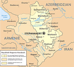
Map of Artsakh, 1994-2020
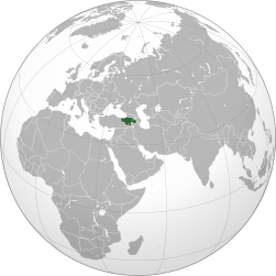
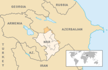
Location of Artsakh in the Caucasus region
Artsakh in the Caucasus region

Maps of divisions

This section holds maps of the administrative divisions.

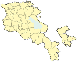
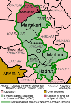
Provinces of Artsakh before 12/2020 (with the names of historical counties):
  1. Mardakert (Jraberd)
  2. Askeran (Khachen)
  3. Stepanakert
  4. Martuni (Varanda)
  5. Shushi
  6. Hadrut (Dizak)
  7. Qashatag
  8. Shahumyan (Gyulistan)

History maps

This section holds a short summary of the history of the area of present-day Nagorno-Karabakh, illustrated with maps, including historical maps of former countries and empires that included present-day Nagorno-Karabakh.

Antiquity

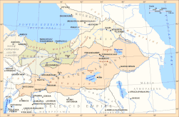
Artsakh within Orontid Armenia, 4th-2nd century BC
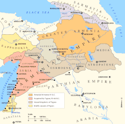
Artsakh within Armenian Kingdom in 95 BC
Artsakh within Armenian Kingdom in 80 BC
Artsakh within Armenian Kingdom in 70 BC
Artsakh within Armenian Kingdom in 50 AD
Artsakh in Arsacid Armenia, 1st-4th centuries AD
Artsakh within Armenian Kingdom
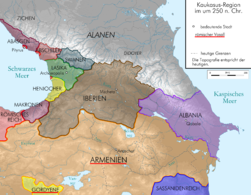
Artsakh within Armenian Kingdom in 250 AD
Artsakh within Armenian Kingdom in 300 AD
Artsakh within Armenian Kingdom in 385 AD
Artsakh within Armenian Kingdom, 4th century
Caucasian Albania and its neighbors, until 387 AD

Middle Ages

Artsakh within Sassanid Empire in 565 AD
Artsakh and Utik, until 591 AD
Artsakh within Umayyad Caliphate in 750 AD
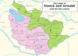
Artsakh and Syunik, until the 9th century AD
Artsakh in 850 AD
Artsakh in 900 AD
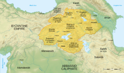
Artsakh in Bagratid Armenia, 9th-11th centuries
Artsakh in Bagratid Armenia, 962-1064
Artsakh in 1000 AD
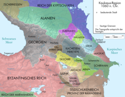
Artsakh in 1060 AD
Artsakh in 1090 AD
Artsakh within Georgia in 1122-1125 AD
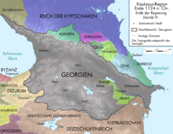
Artsakh within Georgia in 1124 AD
Artsakh within Georgia in 1184-1230 AD
Artsakh in Zakarid Armenia, 12th-13th centuries
Artsakh within Georgia in 1213 AD
Artsakh within Mongolian Empire in 1220-1245 AD
Artsakh within Mongolian Empire in 1245 AD
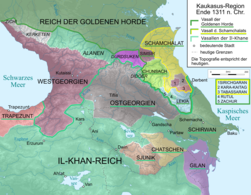
Artsakh within Ilkhanate in 1311 AD
Artsakh within Jalayirid Sultanate in 1380 AD
Artsakh within Timurid Empire in 1405 AD
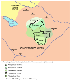
Principalities of Karabakh, 16 century

Early modern history

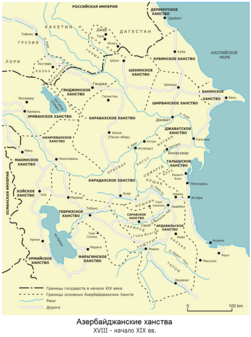
Karabakh Khanate, 18th century
Armenian autonomy in Karabakh, 18th-19th century
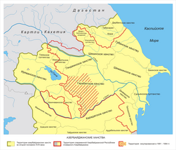
Karabakh Khanate, 18th-19th century
Karabakh Khanate, 19th century
Karabakh within Russian Empire in 1805
Ethnic composition of Elisabethpol province, 1897

Early 20th century

Ethnic Armenians in 1914
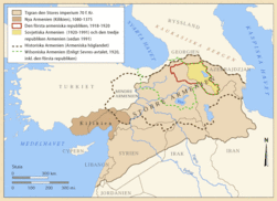
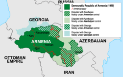
Democratic Republic of Armenia, 1918-1920
Democratic Republic of Armenia, 1919
Proposed borders of Armenia, 1920
Treaty of Kars, 1921
Kurdistan Uyezd (Red Kurdistan, Kurdistan Autonomous Province) and Nagorno-Karabakh in the Soviet Caucasus, 1923-1929
Kurdistani District (Red Kurdistan) and Nagorno-Karabakh in the Soviet Caucasus, 1930
Artsakh in the Soviet-Caucasus, 1923-1988
The Nagorno-Karabakh Autonomous Oblast, 1957-1991
The Nagorno-Karabakh Autonomous Oblast, 1989
The Nagorno-Karabakh Autonomous Oblast

Modern history

Subdivisions in 1991

Old maps

This section holds copies of original general maps more than 70 years old.

A map of the Caucasus, London 1770
Map of the Caucasus, The Caucasus, Ivan Golovin, 1854
Map of Great Armenia, 1869
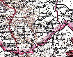
Russian map of Karabakh, 1890-1906

Ethnic maps

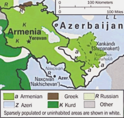
Ethnic map of Nagorno-Karabakh

Regions

Historical Syunik

Politics

Historical regions of Armenia

Notes and references

General remarks:

  • The WIKIMEDIA COMMONS Atlas of the World is an organized and commented collection of geographical, political and historical maps available at Wikimedia Commons. The main page is therefore the portal to maps and cartography on Wikimedia. That page contains links to entries by country, continent and by topic as well as general notes and references.
  • Every entry has an introduction section in English. If other languages are native and/or official in an entity, introductions in other languages are added in separate sections. The text of the introduction(s) is based on the content of the Wikipedia encyclopedia. For sources of the introduction see therefore the Wikipedia entries linked to. The same goes for the texts in the history sections.
  • Historical maps are included in the continent, country and dependency entries.
  • The status of various entities is disputed. See the content for the entities concerned.
  • The maps of former countries that are more or less continued by a present-day country or had a territory included in only one or two countries are included in the atlas of the present-day country. For example the Ottoman Empire can be found in the Atlas of Turkey.
  1. Ըստ սահմանադրության Լեռնային Ղարաբաղի Հանրապետություն և Արցախի Հանրապետություն անվանումները նույնական են։ ԼՂՀ սահմանադրություն, 1.2 archive copy at the Wayback Machine։
  2. ԼՂՀ սահմանադրություն, 1.1 archive copy at the Wayback Machine։
  3. Լեո, «Հայոց պատմություն», Երկերի ժողովածու, հատոր 2, Երևան - 1973, էջ 32-33։
  4. Constitution of the Nagorno-Karabakh Republic. Chapter 1, article 1.2. Archived from the original on 2013-01-29. Retrieved on 2011-03-09.
  5. Official website of the President of the Nagorno Karabakh Republic. General Information about NKR
  6. Stepanakert is officially known as Xankəndi in Azerbaijan, transliterated as Khankendi)

Entries available in the atlas

General pages
World
Continents and oceans
Themes
Historical eras
States with wide recognition
States with limited recognition
Dependencies and other overseas territories
Country subdivisions
Belgium
India
Pakistan
United Kingdom
Other
Disputed subnational territories
Other regions
Former sovereign states
Former dependencies and overseas territories
Former disputed territories


References